National Scenic & Historic Trails
National Scenic & Historic Trails
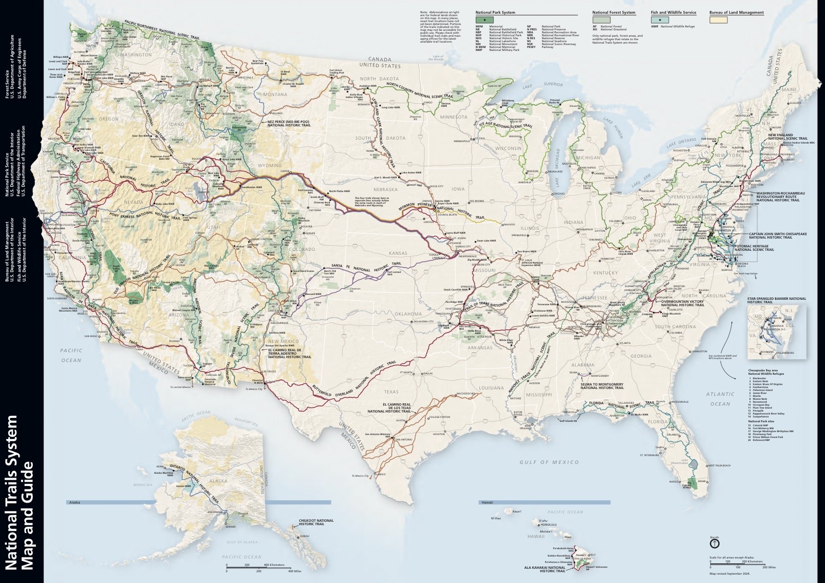
Stretching thousands of miles across the United States, National Scenic and National Historic Trails connect people with the country’s landscapes, history, and culture. Scenic Trails showcase exceptional natural beauty and outdoor recreation, while Historic Trails follow the routes of explorers, pioneers, traders, and Indigenous peoples. Whether you’re hiking a few miles or planning a thru-hike, these trails invite you to experience America’s public lands one step at a time.
I actually think these would pair really well with the style you’re moving toward. Imagine each one as a full-width section with a beautiful hero image, a short blurb like this, and a “Explore on the Interactive Map” button underneath. That’s very much the Garmin/onX style of presenting information: a striking visual, a concise explanation, and a clear next step.
Click on the map to take you to the National Park Service Website for the National Trails System.
Long Trail Alerts (AT • CDT • PCT)
Updated April 2026
🥾 Appalachian Trail (AT)
⚠️ General Conditions (2026 Season)
The AT remains fully open overall, but conditions vary widely by region
Seasonal issues include:
Storm damage
Mud season (especially in the Northeast)
Localized trail reroutes and maintenance
👉 View Official AT Alerts & Updates
🧭 Key Notes
Many sections pass through National Parks and Forests, so closures are often local, not trail-wide
Shelters, privies, or short trail segments may be temporarily closed
🏔️ Continental Divide Trail (CDT)
🚧 Southern Terminus Restriction (Major Alert)
Access to the southernmost 1.1 miles is restricted
Area designated as a National Defense Area (NDA)
Permit required to reach the official monument
🪖 What this means
Free permit required (apply in advance)
Non-U.S. citizens require an escort
Heavy construction traffic and possible delays
Road closures may occur as border construction continues
🔥 Fire Restrictions (CDT Corridor)
Sections of the CDT (especially Colorado) may have active fire restrictions
Example: Pike-San Isabel NF restrictions affecting CDT miles ~1068–1201
🌄 Pacific Crest Trail (PCT)
⚠️ Multiple Active Closures & Alerts
🔥 Southern California
Trail damage from storms near Whitewater & Mission Creek
Fire-related alerts near Acton / Agua Dulce (Crown Fire)
Closure areas near Deep Creek (Aztec Falls area)
🏔️ Central California
Reds Meadow Road closure (affects access)
Bridge damage (West Walker River area)
🌲 Northern California
Fire-related restrictions (including legacy impacts from Dixie Fire)
Private land access restrictions due to fire risk
🌧️ Oregon
Eagle Creek Trail closure due to storm damage (Dec 2025 event)
🏔️ Washington
Alerts in Glacier Peak Wilderness (conditions variable)
🧭 Additional 2026 Notes
Southern California experienced recent flooding and trail damage
Expect rough tread, washouts, and changing conditions
🧭 Before You Go (Long Trail Edition)
Long trails are not single places—they are corridors of constantly changing conditions.
👉 Always check:
Trail association websites
Local land management alerts (USFS, NPS, BLM)
Weather and fire conditions
A long trail is never the same twice. Stay aware. Adapt. Keep moving.